 Family Roots Publishing recently released the all new American Migration Routes Part I – Indian Paths, Post Roads & Wagon Roads; by William Dollarhide. If I may say so, this book is amazing. We still have a few signed copies available.
The above link goes to Biblio.com, where a paperback or papeerback/eBook bundle copy can be ordered with little hassle. Purchase a bundle of the print book, and the eBook at Biblio.com for an additional $10.00.
You can also order at the FRPC website – in paperback, PDF eBook, and a bundle of the paperback & eBook. However, we aren’t taking Credit Cards at the website at the moment. So if you order there, please follow the onscreen instructions at checkout and call me after the purchase with a card number or send a check, once the order is placed. If paying by CC, that call doesn’t need to be immediate, but within 24 to 48 hours between 9 am and 5 pm PDT. Note that placing the order puts your order into the queue. There are very few signed copies available, but will ship them as long as we’ve got them in stock.
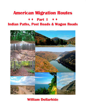
American Migration Routes Part I – Indian Paths, Post Roads & Wagon Roads; by William Dollarhide; 2022; 139 pp; Full Color Throughout; Soft Cover; Perfect-bound; 88 Maps; 77 Routes; ISBN 978-1-62859-335-8; Item #: FR0486
Did your ancestors migrate from one place to another within the United States between the years 1630 and 1869? Would you like to trace that migration path as it is today? Would you like to recreate that move – either by road-trip or virtually, while at home? This all-new book will allow you to do those things.
American Migration Routes, Part 1 includes 88 maps and 77 routes. It has seven (7) chapters, each illustrating a specific era of American transportation history:
1. Indian Paths to Post Roads (1630-1669)
2. The King’s Highway (1680-1765)
3. Scots-Irish Wagon Roads (1720-1750)
4. Trans-Appalachian Trails & Roads (1755-1796)
5. Roads to the Ohio Country (1787-1818)
6. Roads of the Old Southwest (1806-1832)
7. Western Migration Routes (1821-1869)
A 12-page Table of Migration Routes acts as an introduction to the map chapters with road trips, notes, and links to historical references online. Each chapter starts with a locator map and introduction to the historic era.
The migration routes are then enlarged on two side-by-side maps: the left-hand page has the highlighted trace of a migration route on a modern highway map; the right-hand page has the same trace on a county boundary map.
For all states, the Modern Highway Maps were adapted from the USGS National Map and show a highlighted old migration route as part of the current State, US, or Interstate Highways. These maps were designed to enable a road trip that follows the trace of the old migration route. At each numbered migration route, an arrow symbol indicates the road trip directions necessary to repeat the journey today.
The County Boundary Maps were adapted from the USGS Base Map of the U.S. No. 2b East as well as various other base maps showing current state and county boundaries. The county boundary maps were added for genealogists and the researchers who need to know the place on the ground where their ancestors may have left records of an event, i.e., a birth, marriage, death, or burial. Finding the place of an event necessitates a discovery of the exact cemetery, town hall, or county courthouse where the records are found today.
The volume also includes two appendices:
1. 1860s Travel Times on the Routes to San Francisco, California
2. The Trail of Tears: Routes of the Five Civilized Tribes. An historical timeline of the events leading to the Indian removals.
First Reviews
“This is a fantastic volume. It has been so clearly updated with beautiful maps and illustrations. The bibliography is replete with books and online resources to aid in research. The Table of Migration Routes brings together the old trails while referencing what the current roads and highways are today. The maps and descriptions of the routes are dear and easy to follow.
“Within the seventy-seven examples one is bound to find the pathway taken by your ancestors as they migrated across the state or across the country. Every serious American researcher should have this book close at hand.” Peggy Clemens Lauritzen, AG, FOGS Utah Genealogical Association, Board Member Association of Professional Genealogists, Board Member
“I think the idea of plotting the migration routes on contemporary highway maps was a master stroke. The astute observer will note the parallels between the historic trails and contemporary transport. It will also help them relate to the landscape they know and understand.
“The focus of this work is timely. There has been a rush by Americans to discover their origins. Understanding the BMD of it all is important, but the geographic context of their ancestor’s heritage was blazed by those who came before, and of course those who followed.” Howard Mathieson, Faculty, Univ. of Winnipeg (Retired), Leader of the 11,100-member Ulster Scots I Scots Irish Genealogy Group (Public Facebook Group).
What an amazing book. The maps are so detailed, I could spend hours analyzing them. So much valuable information is packed in one book. A must have for every genealogist. I’m excited to now dig a bit deeper into my ancestors’ migrations, and with this book figure out the paths they took. Looking forward to Vol 2. Linda Debe, The Sleepless Genealogist