by William Dollarhide
In April 1860, one year before the Civil War began, my Great-Grandfather, Rev. John Dollarhide, and family, left the town of West Union, Iowa, to embark on a 3-month journey to California. John Dollarhide (photo below) was an ordained minister with the Church of the United Brethren in Christ. He had recently been the pastor of a Methodist Episcopal Church in West Union IA. The purpose of Rev. John Dollarhide’s trip to California was to take up duties as a United Brethren Home Missionary in the Central Valley of California. He would be joining his 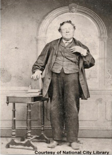 good friend and colleague, Rev. Israel Sloan. In 1858, the UB Church’s Board of Missions in Dayton, Ohio had sent Rev. Sloan to establish their first mission in California. Rev. Sloan and Rev. Dollarhide’s appointments were both mentioned in detail in the UB Church’s publication, The Religious Telescope. By 1860, Rev. Sloan had already reported success in the California mission. One of the attractions of the United Brethren was their position of anti-slavery and anti-free masonry. People who shared those beliefs were more prone to join a new UB congregation being established there. (California was a free state and supported Abraham Lincoln in the Nov 1860 Presidential Election).
After arriving in California in July 1860, the Dollarhide family first settled in Woodland, Yolo Co CA, on the Sacramento River; later, they acquired a farm near the community of Paradise in Stanislaus Co CA. It was no coincidence that Woodland was also the home of Evan Williams Dollarhide, a cousin. Evan and his sons Winfield, Alexander, and Andrew Dollarhide, were prominent horse-traders in the Sacramento area. Like John, Evan was born in Indiana and had also lived in Iowa before coming to California in 1850. John and Evan had communications before John’s trip to California. Upon learning of John’s plan to come to California, Evan had encouraged him to come to Woodland first. As it turned out, Rev. Israel Sloan and family were residing across the river in Sacramento, so the Dollarhides had both friends and relatives to help them settle into their new home. And, a year later, John’s brother Jesse Dollarhide and large family followed the same route from Iowa to California, also landing at Woodland CA. Jesse took his family down the river closer to Vacaville CA soon after.
In order to pursue his ministerial duties in California, Rev. John Dollarhide often left his family in Woodland in the care of his wife, Lucy, and oldest son William H. H. Dollarhide. John adopted the trade of an itinerate peddler, selling and bartering goods and produce between several towns and surrounding farms between Sacramento and Fresno CA. For the first few years, he used that livelihood to support his travels and organization work with nursery church groups. By 1865, he had established several small congregations and provided pastoral duties to each as a circuit rider. By then, he had the support of each of his congregations and could spend more time with his family between Sunday trips.
On Dec 22, 1869, John Dollarhide was struck by a fatal heart attack at the age of 54. His obituary gave the exact date and cause of death, but family tradition says that he died in the middle of a sermon in a field near Lodi CA. His burial site was a cemetery in Woodbridge, a community next door to Lodi, but the wooden marker is long gone. Fortunately, an old sexton’s record book was found and published in a local genealogical bulletin, which confirmed the exact plot location of the burial, plus Rev. John Dollarhide’s birth and death years.
The Dollarhide Trip to California in 1860
John Dollarhide and Lucy Reynolds were married in 1836 in Tippecanoe County, Indiana. He was 21; she was 16. They were the parents of 15 children, 5 of whom had died in a typhoid epidemic in Jasper County, Indiana in the 1850s. The 1860 trip over the Oregon-California Trail began with John, Lucy, and eight children. At the start of the California trip in April 1860, my grandfather, John Conrad Dollarhide, was 2 years old, the youngest of the family. But not for long. My Great-Uncle Israel Sloan Dollarhide was born in June 1860… according to his 1937 death certificate, his birth took place “…somewhere along the Platte River of Nebraska.”
The oldest son was Jesse Dollarhide, age 23 in 1860, who handled the wagon teams and cattle for the first half of the journey. When the Dollarhide wagons reached Fort Kearney, Nebraska Territory (the junction of the Oregon Trail/Sublette’s Trace from Independence MO), they encountered a party of Kansas Militia recruiters. They were asking for volunteers to fight in the impending War of the Rebellion. Jesse volunteered, followed the recruiters back to Fort Leavenworth, and was mustered into the 1st Kansas Infantry. Jesse’s parents and siblings continued on their way to California. They never saw Jesse again. It was not for years later that the death of young Jesse Dollarhide was recorded in Rev. John Dollarhide’s family bible. He was killed in the Battle of Wilson’s Creek near Springfield MO in August 1861.
NOTE: A blog article about my successful search for John Dollarhide’s family bible is available. See www.genealogyblog.com/?p=20033.
Their 1860 California trip involved three covered wagons, each pulled by pairs of hearty oxen; and the family also brought along a herd of cattle, calves, pigs, goats, and horses. Because of preserved memories of the trip to California by relatives I have an accurate account of an incredible trip with details about the good experiences; the many perils and dangers, and the points of interest along the way. For example, I learned that the Dollarhide wagons were not part of any particular wagon train, but that they often camped with larger groups. Events of the journey were recorded, such as picnics and swimming jaunts to the river, or visits to interesting historic sites like Chimney Rock or Independence Rock, or fond memories of the lively dances held around the campfires in the summer evenings. Of course, John Dollarhide, as the only preacher around, was asked to give Sunday sermons to gathered wagon train members.


Some history of the Oregon-California Trail
– The first organized wagon train to use the Oregon-California trail was the 1841 Bartleson-Bidwell Party. They followed the Oregon Trail from Independence MO to Fort Bridger WY then north to Soda Springs ID, where the party divided with half going to Oregon (via Fort Hall ID), and the other half to California. The latter half followed the Walker Route through the City of Rocks, then to Wells NV at the Humboldt River, and then to Reno, Donner Pass, and on to Sacramento via a route very close to present I-80 all the way.

– Sublette’s Cutoff began in 1844 at Parting of the Ways WY, just west of South Pass WY. The right fork cut 70 miles off the distance to Fort Hall ID, bypassing Fort Bridger WY. See www.nps.gov/nr/travel/american_latino_heritage/California_National_Historic_Trail.html.

– In 1846, the Hastings Cutoff began at Fort Bridger WY, then south to the Great Salt Lake, then west, crossing the Bonneville Salt Flats to Wells NV, connecting with the Bartleson-Bidwell route at the Humboldt River. The Hastings Cutoff from Fort Bridger to Salt Lake became part of the Mormon Pioneer Trail a year later. The first wagon train to follow the Hastings Cutoff was the 1846 Donner Party. In fact, the cause of the Donner Party’s disastrous crossing of the Sierra Mountains (trapped by a snow storm) was that they were delayed for over two months, taking an untried shorter route from Fort Bridger rather than the longer, better-watered route via the City of Rocks. At Fort Bridger, Lansford Hastings talked the Donner Party into taking his new trail but forgot to tell them that no one had ever tried the trail pulling wagons. Hastings had followed a map by John C. Fremont, who had proposed the route a year earlier. Both men rode the trail on horseback. Hastings made a copy of Fremont’s map labeled “Hastings Cutoff,” and left it at Fort Bridger – the only reason the trail got his name.
The migration period of the California Gold Rush began in 1849 and the Hastings Cutoff was the first route used to get to the Gold Fields of California. Yet, the route proved to be the worst possible path to follow and was abandoned a year later. Back in 1846, the first obstacle of the Donner Party on the Hastings Cutoff was the heavily timbered forests of the Wasatch Range of Utah, where they were forced to blaze, chop, and clear all new paths for their wagons to pass. Once they reached the Great Salt Lake, the Donner Party saw nothing but flat, easy traveling – that is, until they reached the Great Utah Desert.
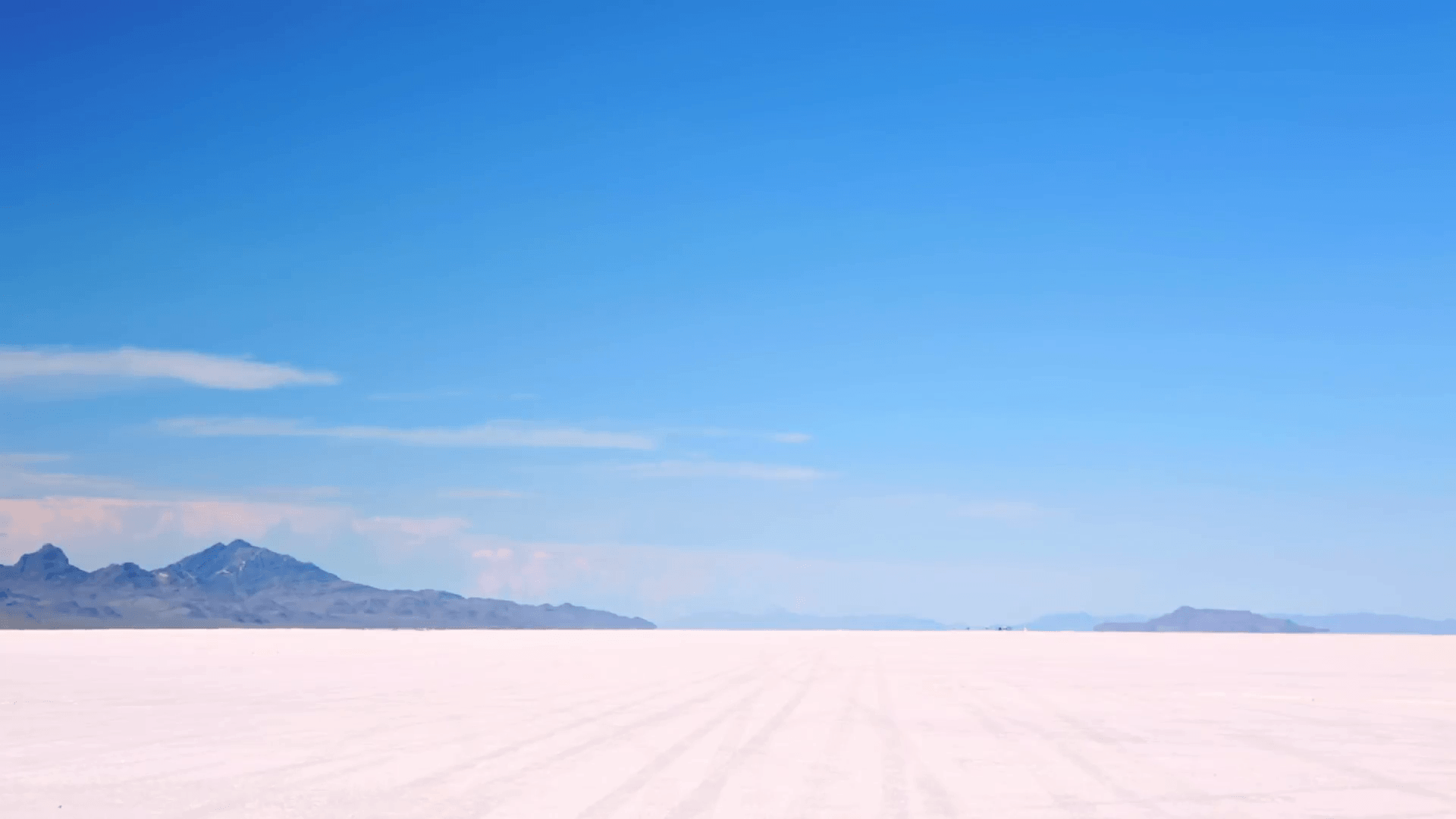
It is still possible to see signs on the ground of the pioneers who took the same trip 1846-1850. There are still remnants of debris scattered across the dry lake bed of the Bonneville Salt Flats, 80 miles by 200 miles in size. The bones of horses, cattle, and recognizable parts of old iron Franklin Stoves, pieces of pianos, wagon wheels and other parts of Conestoga wagons, and a myriad of other debris that were dumped from wagons trying to lighten their load. With adequate water available, animals could have made the crossing in about 6 days. With no water, many of the animals did not survive the difficult job of dragging covered wagons across one of the most desolate places on the planet. After a rain, they suddenly had water – but pulling wagons through the quicksand was now impossible.
In 1850, the part of the Hastings Cutoff route from Salt Lake City UT to Wells NV was abandoned. The Mormon wagon trains bound for the Great Salt Lake continued to use the route through the Wasatch Mountains, improving the first clearing work done by the Donner Party; but the California-bound wagons trains went back to the Bartleson-Bidwell route from Fort Hall ID through the City of Rocks to Wells NV. Advice on the best route to take after 1850 came earlier on the trail, e.g., at Fort Laramie, the California-bound wagons were told about the Parting of the Ways, and to take the Right Fork (Sublette’s Cutoff) to Fort Hall, and the Salt Lake-bound wagon trains were told to take the Left Fork to Fort Bridger.
How my own journey on the Oregon-California Trail happened…
Beginning in 1981, my part-time business was called Dollarhide Systems, a publisher of genealogical supplies, books, and software. Working from the back-porch office at my home in Blaine WA, I advertised products in the Genealogical Helper and built a small mail-order business. By 1985, that mail-order business had grown into a full-time operation; an office in Bellingham WA with two employees; and I had quit my job as an Associate Architect at Western Washington University. My main selling opportunity was as a genealogical lecturer and bookseller. I was able to set up seminars with genealogical societies all over the country. I did this at over 100 genealogical societies each year from 1985 to 1994. One society that asked for a seminar in 1990 was in West Union IA, the Fayette County Genealogical Society. I jumped at that one because that was where Rev. John Dollarhide and his family lived before their trek to California. So after getting the West Union group signed up, I checked the map of the Oregon-California Trail for more genealogical societies. I was able to book seminars for the Fort Kearney Genealogical Society in Kearney NE; and the Root Cellar Sacramento Genealogical Society. A seminar for the Bannock County Idaho Historical Society (Pocatello Junction ID, site of the Fort Hall replica) was attempted but we could not settle on a good date.
In 1990, my trip was planned before I ever heard the word “internet.” Using only a Rand-McNally Road Atlas, I was able to plot the modern highways that are close to the Oregon-California Trail. It was not that difficult… much of the trail (via Salt Lake City anyway) is now called I-80. But I knew that the route followed by the wagon trains on the Oregon-California Trail in 1860 departed from I-80 at several points, e.g., head north to the South Pass crossing of the Rocky Mountains in Wyoming, and a then by-pass Fort Bridger at the Parting of the Ways junction to the Sublette Cutoff. But, if I were to map a journey on the Oregon-California Trail today, I would do the following:
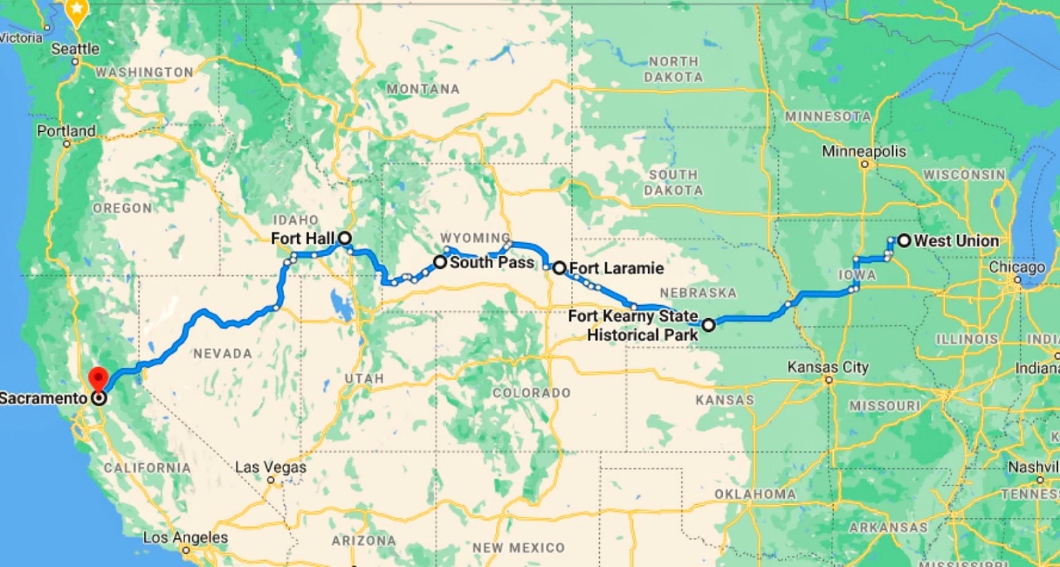
Go to Google Maps – Directions. The travel directions map can be initiated from the basic Google search screen, e.g., by typing two points desired, such as “West Union IA to Sacramento CA.” This will bring up an inset map at the Google results list that can be clicked on to enlarge the map image into the regular Google Maps screen. Google Maps predicts the fastest route, but not necessarily the shortest route between two points on a map. Any historic route needs to be introduced to Google, so at this point, the map can be zoomed in or out to modify the first default route chosen by dragging the blue line highlighting the selected route. Adding in-between destinations/stops helps refine the route, e.g., adding Fort Kearney NE; then Fort Laramie, South Pass, and Fort Hall WY adjusted the map route to match more closely to the trace of the 1860 Oregon-California Trail. (This method was used to produce the map below). To start with Google Maps, see https://maps.google.com.
Dear Cousin Bill, Thank you for more of the story. I am a descendant of the Rev William Dollarhide. His daughter Frances married John Johnston and died in Cedar, Smith County, Kansas. Elizabeth Snow
Hi Bill, My ancestor’s brother died on the Hastings Cutoff in 1852. So a couple of people attempted to use it from time to time (his marker still exists)!
Hi Cheri, Where is the marker?
My family is from Jesse’s lineage. Apparently I named my child after one of the Dollarhides. Who knew? Not I!