This is great news! The pre-1923 Sanborn Fire Insurance Maps have now been digitized and are available to us at the PennState website.
The following teaser is from their site:
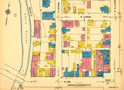
Recently Penn State’s University Libraries completed the cataloging and digitization of the entire collection of Sanborn maps that span the late 19th and early 20th centuries — 31,036 sheets, representing 585 large and small communities across the Commonwealth. Titles published before 1923 and available online to the public are presented in an alphabetical index of Pennsylvania communities at www.libraries.psu.edu/psul/digital/sanborn.html. As copyright restrictions are lifted for post-1922 titles, the scanned images of those communities also will be mounted on the Maps Library’s Sanborn Fire Insurance Maps website for use.
Click here to read more at the PennState site.
Thanks to ResearchBuzz for the heads-up.