 German maps are incredibly popular and extremely important to German research. During the middle ages and on up to the First World War a modest portion of western-central Europe was a land of ever changing boundaries. In the heart of this area were the German people. At different times, different rulers and governments ruled the various lands, including areas of modern France, Austria, and more. As maps changed, so did the names of towns and parishes throughout the region. At one point a town may have a German name, and at another time a French name. Sorting out the names of places, as they would have appeared on records and documents at any particular time in history is difficult. Fortunately, researches have spent countless hours reviewing and documenting these variation.
The most popular of the German Maps sold at Family Roots Publishing are the Map Guides to German Parish Registers. Currently there are forty volumes and counting. The complete list is given below.
Other useful map guides sold at Family Roots Publishing include:
Baden: Atlantic Bridge to Germany [read a book review here]
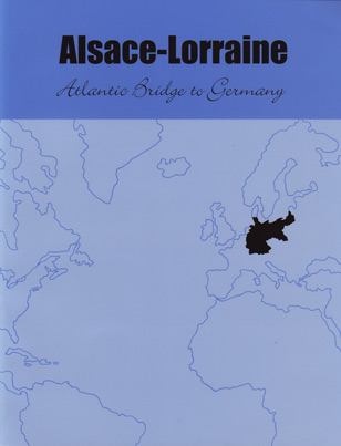
Alsace-Larraine: Atlantic Bridge to Germany [read a book review here]
The Lands of the German Empire and Before [read a book review here]
German Maps & Facts For Genealogy [read a book review here]
More about the German Parish Maps and a list of volumes:
Map guides help make finding German Parishes easier. Each guide maps and lists parishes for a specific region, covering the mid to late 1800s. These maps serve as a “snapshot” to the parish districts as they existed at that time. Parishes were defined by the town to which they were assigned, and vice versa. Like the other volumes in this series, this map book offers the following:
- Identifies the parish where an ancestor worshiped based on where they lived.
- Gives the FHL microfilm number for the family’s parish records.
- Identifies nearly every city, town, and place that included residents.
- Visually identifies church parishes for Lutherans & Catholics in each district.
- Identifies adjoining parishes in case an ancestor attended an alternate parish.
- Aids in area searches, particularly across district or regional borders.
- Provides visual identification of search areas in which to look for a family.
- Helps in determining proximity of one area to another.
- Aids in determining reasonable distances of travel from one area to another.
- Identifies population centers in each parish.
- Identifies archives, repositories, and other resources.
- Aids in identification of the location of minority religions.
Each guide come in both hard and soft cover options. Click the link below for the soft cover or the link “[hard cover]” for the hardback:
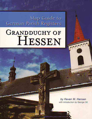
 Map Guide To German Parish Registers – Hessen – Vol. 1 [hard cover]
Map Guide To German Parish Registers – Baden, Second Edition – Vol. 2 [hard cover]
Map Guide To German Parish Registers – Mecklenburg – Schwerin & Strelitz – Vol. 3 [hard cover]
Map Guide To German Parish Registers – Oldenburg & Schleswig-Holstein – Vol. 4 [hard cover]
Map Guide To German Parish Registers – Württemberg I – Jagstkreis – Vol. 5 [hard cover]
Map Guide To German Parish Registers – Württemberg II -Neckarkreis & Hohenzollern Province – Vol. 6 [hard cover]
Map Guide To German Parish Registers – Württemberg III – Schwarzwaldkreis – Vol. 7 [hard cover]
Map Guide To German Parish Registers – Württemberg IV – Donaukreis – Vol. 8 [hard cover]
Map Guide To German Parish Registers – Hessen-Nassau I – RB Wiesbaden – Vol. 9 [hard cover]
Map Guide To German Parish Registers – Hessen-Nassau II – RB Kassel – Vol. 10 [hard cover]
Map Guide To German Parish Registers – Rhineland I – RB Aachen & Düsseldorf – Vol. 11 [hard cover]
Map Guide To German Parish Registers – Rhineland II – RB Köln & Koblenz – Vol. 12 [hard cover]
Map Guide To German Parish Registers – Rhineland III – RB Trier & The Pfalz (Palatinate) – Vol. 13 [hard cover]
Map Guide To German Parish Registers – Bavaria I – RB Unterfranken – Vol. 14 [hard cover]
Map Guide To German Parish Registers – Bavaria II – RB Oberfranken – Vol. 15 [hard cover]
Map Guide To German Parish Registers – Bavaria III – RB Mittelfranken – Vol. 16 [hard cover]
Map Guide To German Parish Registers – Bavaria IV – RB Oberpfalz – Vol. 17 [hard cover]
Map Guide To German Parish Registers – Bavaria V – RB Schwaben – Vol. 18 [hard cover]
Map Guide To German Parish Registers – Bavaria VI – RB Niederbayern I – vol. 19 [hard cover]
Map Guide To German Parish Registers – Bavaria VII – RB Niederbayern II – Vol. 20 [hard cover]
Map Guide To German Parish Registers – Bavaria VIII – RB Oberbayern I – Vol. 21 [hard cover]
Map Guide To German Parish Registers – Bavaria IX – RB Oberbayern II – Vol. 22 [hard cover]
Map Guide To German Parish Registers – Bavaria X – Gazetteer And Index To Volumes 13-22 – Vol. 23 [hard cover]
Map Guide To German Parish Registers – Thuringia – Vol. 24 [hard cover]
Map Guide To German Parish Registers – Kingdom Of Saxony I – Vol. 25 [hard cover]
Map Guide To German Parish Registers – Kingdom Of Saxony II – Vol. 26 [hard cover]
Map Guide To German Parish Registers – Kingdom Of Prussia, Province Of Sachsen I (Erfurt) & Duchies Of Anhalt & Brunswick – Vol. 27 [hard cover]
Map Guide To German Parish Registers – Kingdom Of Prussia, Province Of Sachsen II, RB Merseburg – Vol. 28 [hard cover]
Map Guide To German Parish Registers – Kingdom Of Prussia, Province Of Sachsen III, RB Magdeburg – Vol. 29 [hard cover]
Map Guide To German Parish Registers – Kingdom Of Prussia, Province Of Hannover I, RB Hannover & Hildesheim – Vol. 30 [hard cover]
Map Guide To German Parish Registers – Kingdom Of Prussia, Province Of Hannover II, RB Lüneburg And Stadev – Vol. 31 [hard cover]
Map Guide To German Parish Registers – Kingdom Of Prussia, Province Of Hannover III, RB Aurich & Osnabrück – Vol. 32 [hard cover]
Map Guide To German Parish Registers – Imperial Province Of Alsace-Lorraine I – District Of Unterelsass I – Vol. 33 [hard cover]
Map Guide To German Parish Registers – Imperial Province Of Alsace-Lorraine II (Elsass-Lothringen) – District Of Unterelsass II – Vol. 34 [hard cover]
Map Guide To German Parish Registers – Imperial Province Of Alsace-Lorraine III (Elsass-Lothringen) – District Of Oberelsass I – Vol. 35 [hard cover]
Map Guide To German Parish Registers – Imperial Province Of Alsace-Lorraine IV (Elsass-Lothringen) – District Of Oberelsass II – Vol. 36 [hard cover]
Map Guide To German Parish Registers – Imperial Province Of Alsace-Lorraine V (Elsass-Lothringen) – District Of Lothringen I – Vol. 37 [hard cover]
Map Guide To German Parish Registers – Imperial Province Of Alsace-Lorraine VI (Elsass-Lothringen) – District Of Lothringen II – Vol. 38 [hard cover]
Map Guide To German Parish Registers – Kingdom Of Prussia – Province Of Westphalia I And The Principalities Of Lippe & Schaumburg-Lippe – Vol. 39 [hard cover]
Map Guide To German Parish Registers – Kingdom Of Prussia – Province Of Westphalia II – Arnsberg – Vol. 40 [hard cover]
Map Guide To German Parish Registers – Kingdom Of Prussia – Province Of Brandenburg I – Vol. 41 [hard cover]